Friday, February 25, 2011

Broadcom Upgrades Its A-GPS Data Service and GPS LTO Product/Service with GLONASS Satellite Support

Broadcom Corporation a global leader in semiconductors for wired and wireless communications,announced the upgrade of its Assisted-GPS (A-GPS) data service to support the delivery of GLONASS (the Russian Global Navigation Satellite System)assistance data for mobile and personal navigation device (PND) users. This service supports two new Broadcom GPS system-on-a-chip (SoC) solutions(announced earlier today) that feature dual constellation support for GPS and GLONASS:
  • BCM47511 -  Integrated Monolithic GPS Receiver
  • BCM2076 - Multifunction Monolithic IC with GPS and GLONASS AGPS, Bluetooth 4.0, and FM Receiver/Transmitter.


In addition to this upgraded A-GPS service, Broadcom also announces that it has upgraded its current GPS Long Term Orbit (LTO) data product and service to support the GLONASS constellation starting with today's introduction of the BCM47511 and BCM2076 GPS SoC solutions. LTO extends the usability of GPS and GLONASS assistance data for up to 7 days and ensures the fastest possible fix time in mobile wireless devices. This augmented data service is a key element for realizing the full effectiveness of the GLONASS constellation and nearly doubles the number of satellites that can be used for navigation.

GLONASS is the Russian equivalent to the U.S. GPS system, and is a complementary and alternative satellite navigation system. By adding GLONASS support, the BCM2076 and BCM47511 GPS receivers will have the ability to use an additional 21 GLONASS satellites currently (24 projected in the future), on top of the existing 30 U.S. GPS satellites, nearly doubling the number of satellites that can be used fornavigation. In urban areas, many GPS satellites are blocked by buildings, so the additional 21 satellites offered by the GLONASS system will provide significant improvements in location performance and accuracy over currently available GPS receivers.

LTO data offers network traffic reduction benefits while improving the user experience. GNSS receivers require a current set of GPS and GLONASS orbit data for a satellite's range measurements to be incorporated into a navigation solution. Without LTO, GLONASS orbit data must be refreshed to a mobile wireless device every half hour (a notably shorter period than the 4 hour refresh requirement for GPS orbit data). With LTO, both GLONASS and GPS orbit data is refreshed every 7 days, saving on network traffic and ensuring the best possible navigation performance.
  • Wireless devices with LTO functionality can provide an initial fix time within seconds, instead of the minutes that may be required to download orbit data from the satellites themselves.
  • In deep urban canyon environments where weak signal conditions often prohibit the refresh of GPS and GLONASS orbit data, LTO becomes a critical element for sustaining high-fidelity GPS/GLONASS navigation
    performance for users.
  • GLONASS orbit data is also supported in Broadcom's Assisted Global Navigation Satellite System (AGNSS) server that enables fast, easy wireless downloads for devices with regular network access, or in use cases that don't require the extended performance that LTO allows.

Broadcom's cutting-edge LTO location infrastructure provides 99.999 percent uptime and uses orbit modeling algorithms, integrity monitoring and operational protocols evolved from its original GPS LTO product, which has been in continuous commercial operation since 2002.
  • Beginning in the first quarter of 2011, Broadcom's LTO infrastructure will serve approximately 2.3 billion LTO downloads every month -- a number that will grow on a weekly basis as devices and the use of location-based services both proliferate.
  • The Broadcom LTO product is part of the company's Location Based Services (LBS) and currently serves over 180 million mobile wireless devices worldwide -- a figure that will increase as the benefits of GLONASS become enabled by the Broadcom BCM47511 and BCM2076 GPS SoC solutions.


The BCM47511 SoC solution is Broadcom's latest generation of standalone receivers, featuring both integrated GPS and GLONASS offers faster signal searches, accurate real-time navigation, improved sensitivity in the urban canyon environment and very low average power consumption.

The BCM47511 is the latest generation of standalone, Global Navigation Satellite System (GNSS) solutions, adding GLONASS functionality, while remaining pin-compatible to the popular BCM4751 GPS SoC solution so customers can quickly upgrade their products to include the benefits of GLONASS navigation support. The BCM47511 also supports the Space Based Augmentation (SBAS) and Quasi-Zenith Satellite System (QZSS) constellations to deliver the best possible navigation performance in any geography.

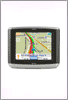
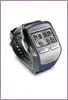
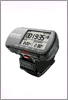
The BCM47511 provides an optimized standalone GNSS solution for smartphones, mobile handsets, personal digital assistants (PDAs), portable media players and portable navigation devices (PNDs).
  • The GPS core of the BCM47511 uses a host-based system architecture that splits processing functions between the GPS chip and the CPU on the host system, significantly decreasing system cost, while allowing customization or optimization of GPS/GLONASS navigation software algorithms on the host. This software is compatible with Broadcom's existing GPS solutions, the BCM4750 and BCM4751, enabling rapid adoption while accelerating time-to-market
  • The host-based architecture permits the GPS software processing tasks to be divided among the chip and the host CPU, so that the BCM47511 performs most of the computationally intensive operations, leaving the host software to implement the final calculations that may be affected by carrier and platform specific requirements. As a result, processing demands on the host CPU are minimized and no real time requirements are imposed
  • The BCM47511 provides low power consumption and an ultra low power tracking mode
  • The BCM47511 also includes on-chip low drop-out (LDO) regulators to supply the GNSS TCXO and optional low noise amplifier (LNA), reducing overall bill-of-materials (BOM) cost
  • Broadcom provides GPS Location Library software API and GPS protocol client software that gives designers complete access to the BCM47511's advanced capabilities

Since it ispin-for-pin compatible with Broadcom's popular BCM4751 SoC solution,customers can quickly upgrade their products to include GLONASS navigation support.

The BCM2076 combo chip is a cutting edge Bluetooth + FM + GPS solution for portable and wireless devices that require Bluetooth, GPS, and a FM receiver/transmitter. It offers audio, Bluetooth 4.0 and improved audio compression that reflects Broadcom's ongoing focus to improve the user experience.
  • Features dual constellation support for both GPS and GLONASS. In addition, to these supported satellites, the BCM2076 combo chip also supports and uses augmentation satellites such as SBAS (Satellite Based Augmentation System) and QZSS (Quasi-Zenith Satellite System).
  • The Bluetooth core is optimized for low power while maintaining high receiver sensitivity and is fully compliant with Bluetooth 4.0.
  • Also integrated is Broadcom's popular SmartAudio® technology that enhances voice quality by supporting Packet Loss Concealment (PLC) and Wide-Band Speech
  • Its FM+RDS/RBDS receiver core is enhanced to support an internal or external FM antenna.
  • It also includes on-chip low drop-out (LDO) regulators to supply the GNSS TCXO and optional low noise amplifier (LNA), reducing overall bill-of-materials (BOM) cost.
  • Integrated InConcert® collaborative WLAN coexistence technology mitigates potential radio interference between Bluetooth and Wi-Fi, and reduces the complexity of designing them into mobile devices
  • Burst buffer operation (allows the host to sleep for 90% of the time during music playback, recording and A2DP operation)
  • MP3, AAC+ on-chip decode for low power music playback
  • Programmable 5-band audio equalizer)

The BCM2076 combo chip is backwards compatible with Broadcom's popular BCM2075 Bluetooth + FM receiver/transmitter.Broadcom products enable the delivery of voice, video, data and multimedia to and throughout the home, the office and the mobile environment. We provide the industry's broadest portfolio of state-of-the-art system-on-a-chip and software solutions to manufacturers of computing and networking equipment, digital entertainment and broadband access products, and mobile devices. 

Broadcom, one of the world's largest fabless communications semiconductor companies, with 2010 revenue of $6.82 billion, holds more than 4,800 U.S. and 2,000 foreign patents, and has more than 7,800 additional pending patent applications, and one of the broadest intellectual property portfolios addressing both wired and wireless transmission of voice, video, data and multimedia.

Examples of such forward-looking statements include, but are not limited to, the demand for Broadcom's Assisted-GPS and LTO products and services incorporating GLONASS and our ability to improve the satellite navigation user experience. These forward-looking statements are not guarantees of future results and are subject to risks, uncertainties and assumptions that could cause our actual results to differ materially and adversely from those expressed in any forward-looking statement.

Important factors that may cause such a difference for Broadcom in connection with the BCM2076 GPS combo chip solution and the BCM47511 GPS standalone chip solution include, but are not limited to:
  • the rate at which our present and future customers and end-users adopt Broadcom's GPS technologies and products;
  • our ability to timely and accurately predict market requirements and evolving industry standards and to identify opportunities in new markets;
  • competitive pressures and other factors such as the qualification,availability and pricing of competing products and technologies and the resulting effects on sales and pricing of our products.

Labels: , , , , , , , , , , , , ,

Thursday, February 10, 2011

GPS satellite phone collar rescue Minnesota's moose

From Voyageurs National Park on the west to the Grand Portage Reservation on the east, researchers from a half-dozen agencies are trying to discover why the Northland’s moose are in decline. New GPS/satellite phone collars may help them get answers.It’s also the first study to track moose on both sides of the international border, with several in Quetico Provincial Park now collared and monitored.

Researchers want to know where moose are going to eat, rest and seek shade and cool water on warm days, and where they go to have their calves and to die. And that’s what this $1.1 million project, funded through federal, state, tribal and provincial sources, is expected to do. Researchers can even overlay what the weather was like, including the temperature, for each position recorded by the GPS.

The work is done in the winter when the black/ brown moose stand out against the snow in the leafless forest, and when marshes and bogs are frozen over.After Northwestern Minnesota’s moose population crashed from 4,000 to just a few dozen over the past 25 years, Northeastern Minnesota moose now are showing similar warning signs. Fewer calves are surviving their first year, and overall moose numbers are trending down.

The new GPS/satellite phone collars ($3,500 each) offer researchers a new world of data. In a pilot project last year, collars on 21 moose in Voyageurs and Grand Portage provided tens of thousands of data-points over just a few months – exactly where each moose was every 20 minutes.

The GPS unit on the collar will take a reading every 20 minutes for at least the next two years, and every four hours a tiny satellite phone calls a researcher’s computer at the Natural Resources Research Institute in Duluth and sends the coordinates.Minnesota moose have been studied for years, but mostly with radio-transmitter collars that require researchers to recapture the moose to recover the data. That requires expensive and time-consuming airplane flights to keep track of the animals. And it may be days or weeks before researchers know the animal is dead.

So far Northeastern Minnesota’s moose population has not dropped to a crisis level. The DNR broadly estimates there are about 6,000 moose in their core survey area in Cook, Lake and northeastern St. Louis counties. But state, federal and regional researchers want to find out all they can before that number drops more.Some moose experts have questioned whether Minnesota moose can survive higher temperatures when they are already at the southern edge of their North American range.’Next winter, if money from the state’s Environment and Natural Resources Trust Fund is approved, DelGiudice and DNR veterinarian Erika Butler hope to put GPS/satellite phone collars another 100 moose to expand the overall study to more than 160.

While Moen’s work focuses on habitat and when and why moose uses certain parts of the forest, DelGiudice and Butler will look at what’s killing the moose.The GPS/satellite collars will allow researchers to know within about 4 hours if a moose stops moving and is likely dead, and, they hope, to get to the dead animal within 24 hours so it can be retrieved for a necropsy.

Labels: , , ,

DeLorme Earthmate PN-60w with SPOT Satellite Communicator

With its selection as a 2011 CES Innovations honoree, along with a Popular Mechanics Breakthrough Award, the Earthmate PN-60w with SPOT Satellite Communicator will clearly be among the leaders in groundbreaking product design at the 2011 International Consumer Electronics Show, to be held January 6-9 in Las Vegas.


DeLorme, a longtime innovation leader in mapping and GPS, will be demonstrating the product's unique GPS navigation and communication capabilities at Booth 3327 at CES, in the Living in Digital Times area (Las Vegas Convention Center, North Hall).

The Earthmate PN-60w with SPOT Satellite Communicator comprises the world's first handheld GPS capable of sending custom text messages using SPOT satellite technology. Ideal for anyone from outdoors enthusiasts to international relief workers, it introduces a revolutionary new way to communicate from remote locations beyond the reach of cell phone coverage.


"This is really two great products in one," said company Vice President Caleb Mason. "DeLorme and SPOT have both pioneered a number of first-to-market innovations. Combining our unique GPS capabilities with SPOT's satellite delivery has produced a one-of-a-kind navigation and communications solution, for peace of mind wherever you go."

In addition to the CES Innovations and Popular Mechanics Awards, the PN-60w with SPOT Satellite Communicator earned National Geographic Adventure Gear of the Year honors, and Wired Magazine included it in its "100 Things We Want" feature. The influential Gear Junkie also accorded it Best in Show honors at the giant Outdoor Retailer show.

Joining Team DeLorme at this year's CES will be world champion and Gold Medal snowboard great Seth Wescott. He will be signing autographs on Friday Jan. 7 from 10:30 to noon at the DeLorme booth; at noon he will be the keynote speaker for the Sport and Fitness Tech Summit conducted by Living in Digital Times.


DeLorme is the longtime leader in innovative mapping and GPS solutions for both consumer and professional markets. The company's Earthmate PN-Series GPS receivers feature rugged, waterproof designs and provide a wide array of DeLorme topographic and street maps, plus aerial imagery and nautical charts. The company's business and government solutions include a variety of World and North America mapping datasets and XMap GIS software tools. Located in Yarmouth, Maine, DeLorme is home to Eartha™, the world's largest rotating and revolving globe.

The SPOT product family uses both the GPS satellite network to determine a customer's location and the Globalstar network to transmit messages and GPS coordinates to others including an international rescue coordination center. Spot LLC, a subsidiary of Globalstar, Inc.provides emergency notification technology that allows users to communicate from remote locations around the globe. Thanks to this affordable, cutting edge personal safety device, the company offers people peace of mind by allowing customers to notify friends and family of their location and status, and to send for emergency assistance in time of need, completely independent of cellular phone or wireless coverage.

Labels: , , , , , , , ,

Saturday, February 05, 2011

CALLAWAY GOLF INTRODUCES NEXT GENERATION UPRO GPS DEVICE

The device introduces a full-color Multi-Gesture Touch Screen and a precise Optical Finger Navigation system so golfers can easily navigate the deep feature set with the swipe of a finger. Pre-loaded with more than 25,000 courses from the Company’s global database, the Upro MX allows golfers to use the GPS device’s offerings straight out of the package. Additionally, Callaway Upro MX is the only dedicated golf GPS system on the market that offers hi-resolution actual aerial photography of each golf course. Available in May for a new product introduction retail price of only $199, the upro mx features no annual fees.

Callaway Golf Company revealed its next generation golf GPS device, the Callaway Upro MX. A successor to the Company’s acclaimed original upro device, which earned a Best of What’s New Award from Popular Science, the Callaway Upro MX sets a new standard for innovation in the category with a host of intuitive technological advancements.


In addition to the improved navigation features debuting in the Callaway upro mx, the Company has developed a simplified online process for downloading content to the device. Some of the on-course features include the Virtual Green View, which uses a proprietary imagery process to show the green and the surrounding area in vivid detail, including exact putting distances.

SmartView displays the ideal view for the upcoming shot based on the golfer’s position on the course, while two other views are also available at the press of a button. Beyond the device’s comprehensive list of standard features, ProMode offers an enhanced feature set, including TV-style video flyovers that provide an advantageous perspective for each hole layout, and AnyPoint Technology, which provides golfers accurate distances from any location on the golf course.

 
The Callaway upro mx features a full-color 2.2” LCD screen in a conveniently compact profile, weighing only three ounces. No annual fees are required after purchase so consumers will immediately have access to both Basic Mode and GoMode. ProMode, which grants access to some of the device’s more advanced technology features, including hi-resolution aerial photography, will be available for an additional fee.

Labels: , , , , ,

Russia restores contact with lost satellite GEO-IK-2 after entering into the wrong orbit


Russia restored contact on Wednesday with a military satellite that went missing the day before after entering into the wrong orbit, in the latest setback to the Kremlin's ambitious space programme.

The GEO-IK-2 satellite, designed to measure the shape of the Earth, blasted off from the Plesetsk launchpad in northern Russia on Tuesday but mission control soon lost contact with it.

The mishap follows a failed launch two months ago of three satellites at the centre of a Russian global satellite navigation network designed to rival the U.S.-made GPS system.

"The parametres of the satellite's orbit have been established. Currently, there is stable contact with it," Russia's Space Forces Commander, Lieutenant General Oleg Ostapenko, said in a defence ministry statement.

A commission of experts is studying whether the off-kilter satellite has been stranded in a useless orbit, forsaking its intended mission, the ministry said.

The low-orbit Geo-IK-2 was designed to probe the Earth's gravitational field for potential military use in guiding ballistic missiles. Its civilian use included monitoring tectonic plate movement, ice conditions and ocean tides.

Interfax news agency cited space industry sources as saying that only a long and painstaking investigation can say why the satellite now appears to be on the wrong orbit.


Prime Minister Vladimir Putin has put strong emphasis on Russia's "satellite navigation sovereignty." But the botched December launch cost Moscow over $168 million and delayed by six months plans to complete its GLONASS system.

Space Agency chief Anatoly Perminov last week said three new GLONASS satellites worth 2.5 billion rubles ($83 million) would be launched in May and June to replace those that fell into the Pacific Ocean in December.


The lost satellites were the last of 24 needed for Russia to fully deploy GLONASS, a project that has its roots in Cold War technology used to guide strategic missiles.

Russia has spent over $2 billion in the last decade on the system, personally promoted by Putin to help build Russia's technological independence and stimulate production of domestic consumer devices such as smartphones and vehicle sat-navs.

In a stunt to publicise the new system, Putin even fitted his dog Connie with a collar bearing a GLONASS transmitter.

Labels: , , , , , , ,