Global Positioning Systems (GPS)

Tuesday, July 19, 2011

Aftermarket Garmin Navigation Available for Volvo Models

Having introduced the new Garmin navigation kit on two of its models last year, the Volvo S60 and the Volvo V60, Swedish manufacturer Volvo is now trying to bring all of its models up to date with all the advancement in navigational tool. The same kit used on the two models has now been made available for the entire Volvo range, as an accessory.


The Garmin system, called nuvi 3790, is perhaps one of the thinnest such devices on the market, measuring only nine millimeters. It can be easily integrated into any Volvo car by using the driver's windscreen pillar.

Garmin Nuvi 3790

Garmin's nuvi 3790 features a multi-touch display that is capable of reacting to ten different commands, with the building and the major point of interest being rendered for the driver in 3D. The system uses Traffic Message Channel (TMC) radio data technology to alert the drivers about traffic jams and alternative routes.

The system, which will be offered in two versions, can be used by Volvo owners from around the world, as it comes with pre-loaded maps for Europe, US, Canada, Mexico or Russia (for the nuvi 3790), or with no maps at all, if you chose the 3760 version (in this case, the dealer will install the map for the places you are interested in).

Labels: , , ,

Magellan RoadMate 5175T-LM Traveler GPS navigator with WiFi and TourDirector

The Magellan RoadMate 5175T-LM Traveler GPS is a full-featured, Wi-Fi enabled GPS navigator with a large 5" high-resolution WVGA touchscreen with flexible viewing in portrait or landscape mode, Free Lifetime Map Updates, Lifetime Traffic Alerts, and automatic software updates.Portrait and Landscape Viewing Modes adapt to whatever works best for your personal viewing preference.TourDirector is your personal guide to help you plan visits to nearby attractions and activities.Wi-Fi Web Browser allows you to search for destinations from any location with a Wi-Fi hotspot.It includes location ratings, descriptions, and approximate visit time.Free Lifetime Maps and Traffic Alerts give you the security of knowing you have the latest maps available and the most up to date traffic information.


Magellan has taken a positive step against the onslaught of the tablets with its RoadMate 5175T-LM Traveler GPS, which retains all of the excellent navigation features one would expect from a Magellan product, with just enough touches of tablet to make users feel they are getting functionality from both worlds.

With a Wi-Fi browser to search for local points of interest and the TourDirector feature to choose attractions and plan your day, this companion can keep you on the right path or be your guide to the road less traveled.To make sure that you can choose the best places to stay, play, dine, and more, Magellan has partnered with the most trusted name in travel – AAA. Only Magellan navigators include the built-in AAA TourBook with Diamond ratings and descriptions on AAA-approved places. With the "Where am I?" feature you can identify your location, and if you are a AAA member, you can easily access Roadside Assistance phone numbers from your device.


The device features a five-inch touch screen capable of use in portrait or landscape mode, and it has a built-in Wi-Fi web browser that adds web surfing capability when near a hot spot. This is an impressive non-status quo addition to a dedicated GPS product. North America map data is complemented by Six Million Points of Interest(POI), a Magellan-dubbed TourDirector function, which provides useful information about nearby attractions and free lifetime map updates.

The Magellan Traveler GPS enables you to personalize your travel experience with the OneTouch menu of your favorite places and searches. Bookmark your favorite coffee shop, restaurant, gas station, or bank to find your favorites wherever you travel.Enjoy subscription-free Lifetime Traffic Alerts, Highway Lane Assist(Realistic highway signs point you in the right direction when you’re approaching interchanges and exits, so that you'll choose the correct lane well before your next turn), and Spoken Street Names(Street names and directions are called out so that you have a clear understanding of when to make the next turn while you keep your eyes on the road) to ease your way. Premium maps of the United States, Canada, and Puerto Rico make this companion perfect for everything from local road trips to cross-country travel.

Travel with confidence using the Magellan RoadMate 5175T-LM Traveler, an easy-to-use, GPS navigator packed with premium features, tour planning tools, and free map updates during the lifetime of your device.Navigator has an SD slot.It has the form factor of a thick tablet, it is portable and can be mounted in the car.


Some of Magellan RoadMate 5175T-LM Traveler GPS navigator accessories are :

  • USB Cable with price: $14.99
  • Adhesive Disk with price: $9.99
  • Heavy Duty Extension Mount with price: $49.99
  • USB Vehicle Power Adapter, 2A with price: $24.99
  • AC Adapter –NA/ UK/Europe with price: $24.99
  • Magellan Beanbag Mount with price: $39.99
  • 5" Leather Case with price: $29.99
  • EVA Case with price: $29.99
  • Magellan RoadMate 5175T-LM Windshield Cradle with price: $5.99
  • Magellan RoadMate 5175T-LM Windshield Cradle and Mount with price: $5.99

Labels: , , , , , , , , , ,

Thursday, July 07, 2011

DeLorme inReach with Iridium 9602 SBD transceiver

DeLorme inReach is the first Iridium-based personal communicator to deliver truly global two-way satellite text messaging; delivery confirmations; SOS capabilities; remote tracking, and an Android smartphone interface.The core communications component of the inReach is the Iridium 9602 short-burst data (SBD) transceiver, which provides a unique, two-way communications connection through the world's farthest-reaching satellite network.Iridium's pole-to-pole global connectivity means inReach users can send and receive messages anywhere on the planet.


The DeLorme inReach promises to revolutionize the way people stay affordably connected over the 90% of the Earth's surface not covered by cellular and land-based phone service. Its capabilities address the needs of anyone from outdoors enthusiasts to professional users in remote outposts.The GPS-enabled inReach can be used by itself or paired with either an Android smartphone or a DeLorme Earthmate PN-60w.

The DeLorme inReach has a customizable tracking interval that can be set before you leave if you’re using the device as a standalone or set with the PN-60w or Android application while you are in the field. Set the interval to report every two minutes if you want to share more detail or reduce it to update once an hour if you’re sharing less detail.The inReach is compact, lightweight, waterproof, floatable and impact-resistant, and it can maintain satellite signal lock even in difficult GPS environments.


When using the inReach as a standalone device, users can send pre-loaded text messages to designated recipients, and activate remote tracking, allowing others to follow their travels online via a continually-updated "bread crumb" trail. Unlike other standalone satellite messengers, the inReach provides delivery confirmation via flashing LED lights. In case of emergency, an SOS key can be triggered. The SOS key is protected by a "safety" to prevent false alarms.

When paired with an Android or the DeLorme Earthmate PN-60w, users enjoy full-featured, two-way text messaging (up to 160 characters per message) to and from email addresses and cell phones. Messages can also be posted to Facebook and Twitter.In case of emergency, Android or PN-60w users can describe their predicament so responders can better prepare, and an ongoing dialog can be maintained for mutual status updates.


Any SOS message, whether relayed from a standalone or a paired inReach, will automatically activate remote tracking. That allows rescuers to efficiently zero in on the senders, whether they're stationary or on the move. All of the inReach SOS features are aimed at producing better outcomes and eliminating the critical search and rescue problem of false alarms unnecessarily deploying lifesaving assets.

Android users can drive the inReach GPS signal to their phone, improving positional accuracy to within 10 feet and eliminating the significant battery drain that results when a phone's native GPS is engaged.A free application with DeLorme Topo North America maps will also be available for the Android. Maps can be downloaded to the Android so users won't need to rely on unpredictable cell phone coverage to access the navigation detail. DeLorme Topo North America comes included with the Earthmate PN-60w.

The inReach is compact, lightweight, waterproof, floatable, and impact-resistant, and it can maintain satellite signal lock even in difficult GPS environments. It will be available in October. There are separate models for Android and DeLorme users. Suggested retail price is $249.95. Annual subscription plans begin at $9.95 per month.Android users can drive the inReach device's onboard GPS signal to their phone, improving both positional accuracy and phone battery life. A free application with DeLorme Topo North America maps will be available for the Android.

Don’t worry about building your contact list ahead of time anymore, you can send messages to new addresses right in the field. Communicate important information, change your plans, or just check in to let everyone know that you are okay. Send your message to Twitter and Facebook or a shared map to let them watch your progress and send you a message.

Along with the satellite messaging capabilities, both the PN-60w and the inReach Android app will continue to deliver the same top-quality DeLorme Topographic mapping data with roads and trails, detailed contour and land cover information, points of interest and the DeLorme Atlas & Gazetteer descriptions. We are also working to make the DeLorme Map Library available through the Android application allowing users to view aerial imagery, USGS quad sheets, Canadian topographic maps, and NOAA nautical charts, all available when beyond cell phone coverage.

The DeLorme inReach will require a subscription to access the tracking, messaging, and SOS features. Current plans are to offer three levels: Safety, Recreation, and Pro, with prices starting at $9.95 per month for the safety plan and increasing to offer more in-plan message and tracking units. Plan options will include the ability to move between plan level, if, for example, you find yourself very active in the summer months but only needing safety features during the winter months.

Labels: , , , , , , , , , ,

Thursday, April 28, 2011

Fastrax IT600 Integrates GPS and Glonass in a Single GNSS Receiver Module

Fastrax is a leading provider of high performance GNSS receivers, Software GNSS solutions and tracking systems for device manufacturers and device designers, unveiled the Fastrax IT600, including GPS, Russian-based Glonass, Japanese QZSS and SBAS in a single receiver module. The chip is an advanced multi-constellation positioning receiver IC. It has an embedded RF input with separate GPS/Galileo and GlonassIF outputs combined with 32 dedicated tracking channels that can be assigned to acquire and track any mix of GPS, Galileo, QZSS and Glonass signals. In addition to currently supported Global Navigation Satellite Systems, the Fastrax IT600 is designed to also support other positioning systems such as European-based Galileo and Chinese Compass/Beidou2 in the future.


The new Fastrax IT600 receiver module is specifically designed to serve the needs of the automotive industry. It uses STA8088EX IC from ST. Optionally an AEC-Q100 automotive qualified IC from ST can also be used (STA8088EXA). Manufacturing is done in an ISO/TS 16949 qualified site. Qualification tests on IT600 module are performed as stipulated in the ISO16750 standard: “Road vehicles – Environmental conditions and testing for electrical and electronic equipment”. Enabling both GPS and Glonass generally doubles the number of visible satellites compared with using GPS only, reducing the time to first fix and increasing positioning accuracy, especially while driving in urban canyons. Fastrax IT600 provides ultimate level of reliability and highly accurate positioning even in challenging environments.

The FASTRAX IT600 can utilize an analog gyro and odometer pulse and can later be complemented with a digital 3-axis gyro and differential wheel pulse from a vehicle’s CAN interface in order to compensate for possible unavailability of GNSS signals.Fastrax IT600 supports DR using traditional 1-axis analog Gyro and Odometer Pulse from car. Support for DWP (Differential Wheel Pulse) based DR through CAN interface will be available later.Advanced dead reckoning estimates the position of the vehicle when satellite signals are unavailable – which inevitably happens in tunnels and parking garages.


Fastrax IT600 features 32 dedicated tracking channels that are dynamically assigned to acquire and track a mix of GPS, Glonass, QZSS, Galileo and Compass/Beidou2 signals. The module is able to operate normally with only one of the Global Navigation Satellite Systems (GNSS) or utilize several systems simultaneously.Fastrax IT600 is also Galileo and Compass/Beidou ready with future software upgrades.

Fastrax IT600 is based on the newly introduced ST Teseo II GNSS chipset (STA8088EX), marking the first time a Fastrax module is based on a chipset from STMicroelectronics. The support for multiple GNSS systems and advanced dead reckoning enables module customers to benefit from additional satellite systems and improved tracking capability and accuracy, without having to make different designs for different markets.


Fastrax IT600 supports Assisted-GPS technology, able to provide both fully-autonomous Ephemeris prediction and server-based, predictive assistance using GPStreamTMServer technology provided by Rx Networks.The autonomous predictions are providing accurate fix for 5 days on observed satellites with no server needs.Using server-based GPStreamTMtechnology from Rx Networks, the access of a very compact information (2KB payload) ensures full-constellation predicted ephemeris valid for 7 days.

Fastrax IT600 offers a wide range of interfaces in a tiny form factor. Two UART’s are available for NMEA and RTCM104. A third UART/USB is also available. I2C provides a convenient interface for adding for instance MEMS sensors, EEPROM or other I2C compatible peripherals. A standard 1PPS output is also available. CAN bus is available for DR. The I/O voltages are 3.3V CMOS levels.


Fastrax IT600 features same small form factor as other Fastrax IT multiplatform modules, 16.2 x 18.8 x 2.3 mm, however the pin-out is different. The low power consumption of 80 mW is further decreased with the ability to turn off unused tracking channels.A JTAG interface is also available for custom firmware implementations and debugging. Currently ARM Realview 3.1 compiler and Lauterbach ICE are supported. Support for GNU compilers will be available later.

Unused tracking channels can be turned off for power saving. Enabling Glonass in urban canyons with limited visibility of the sky, the number of visible satellites go up typically with a factor of two compared to, for instance a GPS-only receiver. This means that your fix is guaranteed in most cases.

“The cooperation with STMicroelectronics and the new Fastrax IT600 are important milestones for us towards the automotive market”, said Taneli Tuurnala, CEO and President of Fastrax. “A single module supporting multiple GNSS systems shows that the development of satellite based positioning is on a strong upward curve. Adding full blown dead reckoning support is much appreciated among our existing customer base, in addition to the new customers that have already shown interest in the new product.”

“Fastrax’s worldwide sales channels help bring our GNSS technology to a wider customer base”, said Antonio Radaelli, Navigation & MultiMedia BU Director of STMicroelectronics. “We are selective in choosing partners, and the decision to cooperate with Fastrax for GNSS modules is based on their high level of technical expertise.”

Samples of Fastrax IT600 are available in September 2011, and volume production is estimated to start in October 2011.

Labels: , , , , , , , , , ,

Thursday, April 07, 2011

Spot Satellite Communicator Recalled - not to work below 40 degrees Farhrenheit/4.44 degrees Celsius


Spot LLC has issued a product RECALL on the SPOT Satellite Communicator which is bundled and sold exclusively with the DeLorme Earthmate PN-60w. Spot LLC has discovered that a part, which does not meet operating specifications, was substituted in some SPOT Satellite Communicator devices during the manufacturing process.

Good thing the company is righting a wrong and compensating owners of the affected models.In certain incidents, intended messages may not be transmitted, including requests for help or emergency assistance, when the SPOT Satellite Communicator is used at temperatures below 40 degrees Farhrenheit/4.44 degrees Celsius.Please note this DOES NOT impact the DeLorme Earthmate PN-60w handheld device itself or any other DeLorme product.

SPOT Satellite Communicator RECALLED

Spot LLC is conducting a complete product replacement of all SPOT Satellite Communicators within ESN range:0-2000000 and 0-2019999.As GPSTracklog points out, hopefully this flaw wasn’t discovered during a real emergency.As a DeLorme and Spot LLC customer with a registered SPOT Satellite Communicator account, you are being notified with important safety information regarding your registered SPOT Satellite Communicator device(s).

Please stop using the SPOT Satellite Communicator and follow the instructions below to promptly return the device for an immediate replacement of a new SPOT Satellite Communicator at no charge. Customers who return their affected SPOT Satellite Communicator devices by June 1, 2011 will receive 6 FREE additional months of SPOT service automatically with a new SPOT Satellite Communicator device.

This product recall is limited to the SPOT Satellite Communicator sold exclusively with the DeLorme Earthmate PN-60w handheld GPS only. This DOES NOT impact the DeLorme Earthmate PN-60w handheld device itself or any other DeLorme product. Additionally, this does NOT impact any other SPOT product including the SPOT Personal Tracker, SPOT Satellite GPS Messenger, SPOT IS, SPOT HUG or SPOT Connect.

You must complete the registration at www.findmespot.com/replacement and follow SPOT Recall Replacement Program guidelines. Spot LLC is not responsible for any data loss. Once you complete the registration, you will be forwarded shipping material. You can expect to receive your new SPOT Satellite Communicator within 7 to 10 business days upon receipt of your return. Spot LLC has chosen to self insure the shipment of your SPOT Satellite Communicator, and will assume the risk of loss for any SPOT Satellite Communicator lost during shipment.

If you have an activated service for a recalled SPOT Satellite Communicator, then Spot LLC will extend all active services to which you have subscribed by an additional six (6) months at no cost to you. (e.g. a 12 month service contract will be extended to 18 months). After receipt of the affected SPOT Satellite Communicator, Spot LLC will automatically apply the applicable service extension to your account with no further action from you.

Labels: , , , , , ,

Thursday, March 31, 2011

The LabSat GNSS RF recorder, replayer and simulator - fully test GNSS products without leaving the lab

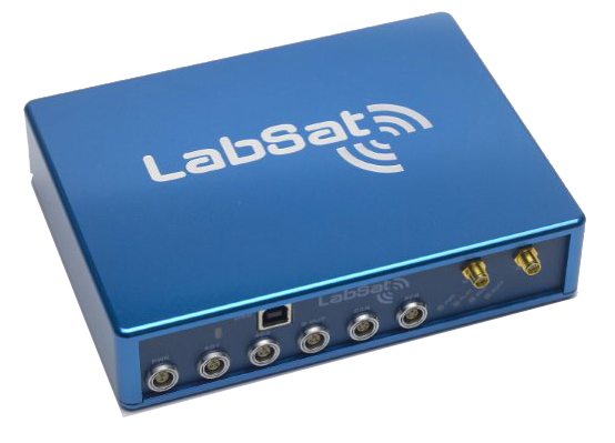
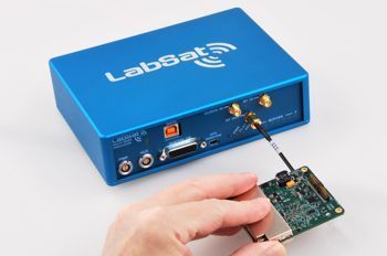
LabSat is a Global Navigation Satellite Systems (GNSS) simulator which connects directly to the antenna input of a GNSS engine and simulates the signals associated with navigation using GPS / GLONASS satellites. Is there a way to fully test GNSS products without leaving the lab?This allows you to carry out many useful (and highly repeatable) tests without leaving the office, saving hours of effort.

LabSat is now used in several industries. For example, Nokia and Blackberry use LabSat for testing smartphones; Mercedes Benz, Bosch and Continental use it to test in-car navigation solutions whilst Northropp Grumman (makers of the B-2 Stealth bomber) and BAE systems use LabSat to test the latest defence technology.LabSat by Racelogic is a low cost GPS Simulator (with Glonass option) which gives you the ability to record and replay real GNSS RF data as well as user generated scenarios.


LabSat is rugged and can be used in harsh environments. It is very portable (LabSat 1 measures 170mm x 128mm x 38mm whilst LabSat 2 is 170mm x 123mm x 46mm) and is supplied with a mains power supply and an automotive 12v adapter. There is also the option of a high capacity battery pack. The RF output power level is adjustable over a 32dB range in 0.5dB steps.

Could different testing methods save you development time and bring your products to market sooner?The data for the simulation is either gathered in the field using the RF recording function, or using the SatGen Software. To record real world data, LabSat simply connects to your PC via USB, and the raw signals from a GPS / GLONASS antenna are streamed directly to hard disk. There are no limitations on the number of satellites being tracked or the length of the recording.


Racelogic, designers of high accuracy GPS data loggers for automotive testing, were looking for a better way to test their products. They found that neither live sky nor GPS simulation were good enough. The dynamic nature of satellite constellations meant field tests were time intensive and not repeatable, whilst modelling satellite signals was expensive and couldn’t reproduce real conditions.

With nothing else available on the market, they decided to design something that could record live GNSS signals and replay these into devices under test, offering the blend of realism and repeatability that they needed at an affordable price.If you are selling, testing or developing products incorporating GPS or GNSS engines, then you'll find LabSat makes your job easier and more effective.

So, in 2008 LabSat was developed, with the ability to record raw GPS RF signals from a live antenna to be replayed at a later date. Users could now easily record a journey and replay this on the bench with identical results.Racelogic then added the ability to create a scenario from scratch, and soon had five units in constant use. From the positive feedback of their R&D engineers, it was clear that LabSat could be helpful to other companies developing GNSS products, at a lower cost than anything else available.


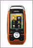
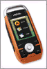
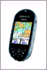
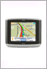
The signal which is recorded is the normal civilian L1 1575.42 MHz type GPS transmission. This is the same signal used in GPS enabled cell phones, Satellite Navigation Devices, asset tracking units and many more. LabSat 2 is also able to record the GLONASS-L1 transmission at the same time with 2-bit sampling, and can also record either GPS or Glonass alone with 4-bit sampling. Replay real world data.

When the data is replayed, your GPS/GLONASS engine will faithfully re-create the movement and satellite reception encountered during the test, including all original multipath, satellite obstructions and atmospheric effects.LabSat units are supplied in a custom padded flight case with a mains power supply, 12v cigar lighter adapter, USB cable, serial cable, various RF connectors to adapt to the target GPS engine, a 250GByte USB disk (36 hours recording using LabSat 1) with pre-loaded scenarios, LabSat control software and a printed manual.

In addition to the RF output, there is an event marker function which is accurate to 62nS and a 1 PPS (1 pulse per second) output. Due to the nature of the signals, LabSat data files are usually very large, requiring 1GB of data for 8m 45s of recording. Therefore LabSat units are supplied with a rugged, portable 250GB USB drive (500GB for Labsat 2). This contains a number of pre-recorded scenarios, and can be used for streaming your own recordings.

LabSat has the unique ability to synchronise with the video from a Racelogic Video VBOX, enabling you to record live video and then replay it, synchronised with the GPS data, and shown as a graphical overlay on the video. Find out more.Additional modules allow the logging and replay of external signals such as serial RS232/422/485 signals, CAN and analogue signals.We supply a remote control OLE application, which means you can fully control LabSat from your own application written in another language. We have sample drivers written in C#, Delphi and LabVIEW.


LabSat is based on brand new USB streaming technology, which has meant that the majority of work in reproducing GPS and GLONASS signals is handled by a standard laptop PC, vastly reducing the complexity and therefore the cost of the hardware.Not only are the cost savings significant, but LabSat includes some powerful features which are either normally only available on top of the range GNSS simulators. Other features are totally unique; for example synchronised video and serial data record/replay and selectable 2 or 4 bit sampling.

LabSat is the most affordable, full constellation GNSS simulator range on the market, making GPS and GLONASS Test and Simulation accessible for any company involved in GNSS design, test or production.LabSat is very repeatable and works with almost any kind of GNSS, including survey grade engines.With high fidelity 2 or 4 bit sampling, LabSat 2 is ideal for testing GPS and GLONASS receiver sensitivity.

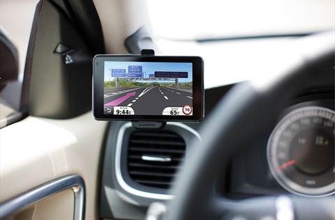
Notable companies now using LabSat include Garmin, Nokia, RIM (Blackberry Smartphone), ST Ericsson, Telefonica, Thales Aerospace, Bosch, Siemens, BMW, Daimler Chrysler, Fujitsu, Broadcom, General Motors, Delphi,Raytheon, Denso, Nav N Go, Seiko Epson and Samsung.

LabSat is designed and manufactured by Racelogic Ltd.,experts in the field of GNSS Testing, Simulation, and data logging. Based in the UK with additional offices in Germany, Racelogic are an ISO 9001 company that supplies specialised GPS and GLONASS based test equipment to many well known corporations in over 80 countries. In 2007 Racelogic were awarded the Queen's Award for Enterprise.

Labels: , , , , , , , , , , ,

Tuesday, March 29, 2011

Route 66 maps + Navigation by TomTom on Android App - "Follow me"

Route 66 joined forces with TomTom at the end of last year in order to create a few new products. One of the first products to come from the partnership is a new Android App, Route 66 Maps + Navigation.The app is compatible with Android 2.1 and later. ROUTE 66 selected TomTom as the provider of map data for ROUTE 66 Maps + Navigation to ensure its users the best possible mapping and navigation experience available. For this brand new app, ROUTE 66 is using TomTom maps, and a wide range of location content such as 3D City Maps, 3D Landmarks and Premium POIs.


MWC, BARCELONA, 2011 – ROUTE 66, a pioneer in mobile mapping and navigation solutions for smartphones and tablets, announces the launch of ROUTE 66 Maps + Navigation, a new app for Android leveraging TomTom's highly accurate maps and enhanced location content.ROUTE 66 Maps + Navigation is the first application coming to market that is based on the global agreement between ROUTE 66 and TomTom announced at the end of 2010.ROUTE 66 Maps + Navigation offers lifetime free access to maps.Turn-by-turn navigation is a premium feature, which can be purchased via the in-app store. See the License menu for the in-app store for actual end-user prices.

This new ROUTE 66 app is a feature-packed mapping and navigation solution for drivers and pedestrians around the globe.Users can explore maps in any direction with multi-touch gestures for zooming, moving, tilting and rotating the view, even during navigation. ROUTE 66 Maps + Navigation provides navigation with clear spoken directions in 57 languages, optional Real Time Traffic and Speed Camera services and a number of unique extras, including the spectacular Follow Me augmented reality feature.The app provides access to the latest crystal-clear maps for over 100 countries, with stunning 3D graphics, packed with handy links to useful information like the weather and Wikipedia. Maps are free to download and also included is a 30 days free worldwide navigation license.


In addition to a full range of premium navigation features, ROUTE 66 Maps + Navigation now has Follow Me. Follow Me shows video of the street in front of you using the camera of the phone or tablet and adds a virtual 3D car driving in front of you. Indicator lights flash to tell you where to turn left or right. This is augmented reality navigation at its best: your own Follow Me car on top of a live camera image, combined with crisp, clear, spoken directions which make finding your way more intuitive and more fun than ever before.

With ROUTE 66 Maps + Navigation users can access map data in various ways. The app automatically downloads the map data needed from high-speed servers to phone or tablet as you go, giving users the very latest and most accurate maps whenever they need it. Users can also store complete maps on their smartphone or tablet using Wi-Fi before they go on the road, avoiding data roaming charges while abroad and ensuring instant access with guaranteed performance, whatever the local network reception.


The app, which will be available on Android devices, will use TomTom’s precise mapping system. But the new app isn’t just a place to store maps. Route 66 Maps + Navigation is packed with features like 3D graphics, spoken directions, and links to weather. But the most impressive aspect of the new package, is Route 66’s “Follow Me” feature.

The “Follow Me” feature places a virtual car on the screen. The virtual car will put on its turn signals and lead you to your destination.Maps rate very highly in terms of quality and reliability, and are updated daily via millions of GPS system users worldwide, who help to track and validate changes in real time.


Labels: , , , , , , ,

Tuesday, March 08, 2011

CellGuide and Rx Networks demonstrated its new XYBRID RT at the MWC

Rx Networks GPStream and XYBRID solutions are integrated with CellGuide's GPSense location engine, which supports CellGuide's ACLYS GPS chip or CGsnap GPS IP baseband.Within the integrated solution, the Rx Networks suite provides both assisted services for the GPS technology and complementary hybrid location technology for WiFi and Cellular-based devices.Based on high-resolution, worldwide digital elevation mapping, HiMap helps as an additional beacon for better navigation accuracy with four or more received satellites, and true 3D navigation with three received satellites.HiMap is now being made commercially available for CellGuide's ACLYS chip, ACLYS IP Core, and GPSense engine.

HiMap greatly improves GNSS navigation performance in urban canyons. City skylines create extremely demanding operational conditions for GPS receivers. Because of this, line-of-sight blockages and erroneous measurements adversely affect the accuracy of GNSS device positioning, tracking and navigation. Using CellGuide's HiMap technology, it boosts GNSS receiver accuracy and availability in built-up areas.HiMap is also available for licensing as an add-on to GNSS receiver manufacturers.

At the Mobile World Congress, Rx Networks demonstrated its new XYBRID RT version 1.0 real time hybrid positioning service that leverages Wi-Fi, Cellular and Assisted-GPS technologies.Designed for use in mobile devices, Global Navigation Satellite System (GNSS) chipsets as well as location applications, XYBRID RT helps determine optimal device location at places where satellite-based navigation falls short. Mobile operators can also leverage the service as a direct positioning solution both for their home networks and LBS roaming.

With the help of a simple HTTP interface, XYBRID RT works comfortably with any application or device form factor, while showing seamless integration with several GNSS chipsets that further improves Time-To-First-Fix.

The device identifies and lists all the detected Wi-Fi access points and cell towers and sends it to the RT server, which in turn analyzes this information to respond with an estimated position along with satellite orbit assistance data, thus enabling GNSS chipsets to acquire precise location. With this hybrid assistance, signal acquisition is significantly accelerated along with improved GNSS receiver sensitivity across both indoor and dense urban locations.

CellGuide, a host based GNSS solution provider, and Rx Networks, a mobile positioning-assistance technology company, are collaborating on delivering multi beacon, hybrid and assisted-GPS technologies.Officials with CellGuide said that both the companies will work to bring to market a solution comprising of the company’s GPSense Multi Beacon Engine and Rx Networks' suite of location assistance products.Using the hybrid service, end-user mobile location experience can be improved considerably with the accelerated three to five second determination of device location.

XYBRID RT, accessed through a simple HTTP interface, can work with any application or device form factor. When a location is required, the device submits a list of currently detected Wi-Fi access points and cell towers to the XYBRID RT server. The server responds with an estimated position based on these observations as well as with satellite orbit assistance data (ephemeris) to help the GNSS chipsets quickly acquire a precise location. This hybrid assistance accelerates signal acquisition and improves GNSS receiver sensitivity in challenging areas, including indoor and dense urban locations. A device’s location can be closely determined within 3 to 5 seconds while the solution rapidly converges to GPS-level accuracy, improving the end-user mobile location experience.

XYBRID RT operates in an anonymous manner without exposing the identity of individual devices. This ensures privacy for both individuals and security-sensitive Mobile Resources Management (MRM) and Machine-to-Machine (M2M) applications. The XYBRID RT service includes real-time satellite ephemeris from Rx Networks’ proven GPStream GRN Global Reference Network, a worldwide grid of GNSS reference stations with highly redundant, real-time views of multiple satellite constellations. The XYBRID RT service is built from the same carrier-grade (99.999% availability) network that Rx Networks’ customers rely upon for E-911 and other priority services.

GPStream GRN provides global real-time and long-term prediction GPS/GLONASS reference data for use by any mobile network location server. GPStream PGPS adds GPS and GLONASS extended ephemeris support to increase the sensitivity and acquisition speed of any GNSS chipset, while XYBRID RT and XYBRID SUPL LE combine Wi-Fi/Cell positioning with real-time A-GPS/A-GLONASS support to extend the location performance of GNSS chips in difficult areas, such as indoors or urban cores.

Labels: , , , , , , , , , , , , , , , ,