Thursday, March 31, 2011

The LabSat GNSS RF recorder, replayer and simulator - fully test GNSS products without leaving the lab

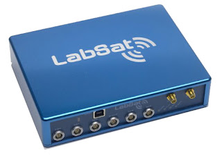
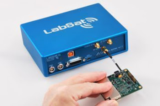
LabSat is a Global Navigation Satellite Systems (GNSS) simulator which connects directly to the antenna input of a GNSS engine and simulates the signals associated with navigation using GPS / GLONASS satellites. Is there a way to fully test GNSS products without leaving the lab?This allows you to carry out many useful (and highly repeatable) tests without leaving the office, saving hours of effort.

LabSat is now used in several industries. For example, Nokia and Blackberry use LabSat for testing smartphones; Mercedes Benz, Bosch and Continental use it to test in-car navigation solutions whilst Northropp Grumman (makers of the B-2 Stealth bomber) and BAE systems use LabSat to test the latest defence technology.LabSat by Racelogic is a low cost GPS Simulator (with Glonass option) which gives you the ability to record and replay real GNSS RF data as well as user generated scenarios.


LabSat is rugged and can be used in harsh environments. It is very portable (LabSat 1 measures 170mm x 128mm x 38mm whilst LabSat 2 is 170mm x 123mm x 46mm) and is supplied with a mains power supply and an automotive 12v adapter. There is also the option of a high capacity battery pack. The RF output power level is adjustable over a 32dB range in 0.5dB steps.

Could different testing methods save you development time and bring your products to market sooner?The data for the simulation is either gathered in the field using the RF recording function, or using the SatGen Software. To record real world data, LabSat simply connects to your PC via USB, and the raw signals from a GPS / GLONASS antenna are streamed directly to hard disk. There are no limitations on the number of satellites being tracked or the length of the recording.


Racelogic, designers of high accuracy GPS data loggers for automotive testing, were looking for a better way to test their products. They found that neither live sky nor GPS simulation were good enough. The dynamic nature of satellite constellations meant field tests were time intensive and not repeatable, whilst modelling satellite signals was expensive and couldn’t reproduce real conditions.

With nothing else available on the market, they decided to design something that could record live GNSS signals and replay these into devices under test, offering the blend of realism and repeatability that they needed at an affordable price.If you are selling, testing or developing products incorporating GPS or GNSS engines, then you'll find LabSat makes your job easier and more effective.

So, in 2008 LabSat was developed, with the ability to record raw GPS RF signals from a live antenna to be replayed at a later date. Users could now easily record a journey and replay this on the bench with identical results.Racelogic then added the ability to create a scenario from scratch, and soon had five units in constant use. From the positive feedback of their R&D engineers, it was clear that LabSat could be helpful to other companies developing GNSS products, at a lower cost than anything else available.


The signal which is recorded is the normal civilian L1 1575.42 MHz type GPS transmission. This is the same signal used in GPS enabled cell phones, Satellite Navigation Devices, asset tracking units and many more. LabSat 2 is also able to record the GLONASS-L1 transmission at the same time with 2-bit sampling, and can also record either GPS or Glonass alone with 4-bit sampling. Replay real world data.

When the data is replayed, your GPS/GLONASS engine will faithfully re-create the movement and satellite reception encountered during the test, including all original multipath, satellite obstructions and atmospheric effects.LabSat units are supplied in a custom padded flight case with a mains power supply, 12v cigar lighter adapter, USB cable, serial cable, various RF connectors to adapt to the target GPS engine, a 250GByte USB disk (36 hours recording using LabSat 1) with pre-loaded scenarios, LabSat control software and a printed manual.

In addition to the RF output, there is an event marker function which is accurate to 62nS and a 1 PPS (1 pulse per second) output. Due to the nature of the signals, LabSat data files are usually very large, requiring 1GB of data for 8m 45s of recording. Therefore LabSat units are supplied with a rugged, portable 250GB USB drive (500GB for Labsat 2). This contains a number of pre-recorded scenarios, and can be used for streaming your own recordings.

LabSat has the unique ability to synchronise with the video from a Racelogic Video VBOX, enabling you to record live video and then replay it, synchronised with the GPS data, and shown as a graphical overlay on the video. Find out more.Additional modules allow the logging and replay of external signals such as serial RS232/422/485 signals, CAN and analogue signals.We supply a remote control OLE application, which means you can fully control LabSat from your own application written in another language. We have sample drivers written in C#, Delphi and LabVIEW.


LabSat is based on brand new USB streaming technology, which has meant that the majority of work in reproducing GPS and GLONASS signals is handled by a standard laptop PC, vastly reducing the complexity and therefore the cost of the hardware.Not only are the cost savings significant, but LabSat includes some powerful features which are either normally only available on top of the range GNSS simulators. Other features are totally unique; for example synchronised video and serial data record/replay and selectable 2 or 4 bit sampling.

LabSat is the most affordable, full constellation GNSS simulator range on the market, making GPS and GLONASS Test and Simulation accessible for any company involved in GNSS design, test or production.LabSat is very repeatable and works with almost any kind of GNSS, including survey grade engines.With high fidelity 2 or 4 bit sampling, LabSat 2 is ideal for testing GPS and GLONASS receiver sensitivity.

Notable companies now using LabSat include Garmin, Nokia, RIM (Blackberry Smartphone), ST Ericsson, Telefonica, Thales Aerospace, Bosch, Siemens, BMW, Daimler Chrysler, Fujitsu, Broadcom, General Motors, Delphi,Raytheon, Denso, Nav N Go, Seiko Epson and Samsung.

LabSat is designed and manufactured by Racelogic Ltd.,experts in the field of GNSS Testing, Simulation, and data logging. Based in the UK with additional offices in Germany, Racelogic are an ISO 9001 company that supplies specialised GPS and GLONASS based test equipment to many well known corporations in over 80 countries. In 2007 Racelogic were awarded the Queen's Award for Enterprise.
Labels: , , , , , , , , , , ,

Tuesday, March 29, 2011

Route 66 maps + Navigation by TomTom on Android App - "Follow me"

Route 66 joined forces with TomTom at the end of last year in order to create a few new products. One of the first products to come from the partnership is a new Android App, Route 66 Maps + Navigation.The app is compatible with Android 2.1 and later. ROUTE 66 selected TomTom as the provider of map data for ROUTE 66 Maps + Navigation to ensure its users the best possible mapping and navigation experience available. For this brand new app, ROUTE 66 is using TomTom maps, and a wide range of location content such as 3D City Maps, 3D Landmarks and Premium POIs.


MWC, BARCELONA, 2011 – ROUTE 66, a pioneer in mobile mapping and navigation solutions for smartphones and tablets, announces the launch of ROUTE 66 Maps + Navigation, a new app for Android leveraging TomTom's highly accurate maps and enhanced location content.ROUTE 66 Maps + Navigation is the first application coming to market that is based on the global agreement between ROUTE 66 and TomTom announced at the end of 2010.ROUTE 66 Maps + Navigation offers lifetime free access to maps.Turn-by-turn navigation is a premium feature, which can be purchased via the in-app store. See the License menu for the in-app store for actual end-user prices.

This new ROUTE 66 app is a feature-packed mapping and navigation solution for drivers and pedestrians around the globe.Users can explore maps in any direction with multi-touch gestures for zooming, moving, tilting and rotating the view, even during navigation. ROUTE 66 Maps + Navigation provides navigation with clear spoken directions in 57 languages, optional Real Time Traffic and Speed Camera services and a number of unique extras, including the spectacular Follow Me augmented reality feature.The app provides access to the latest crystal-clear maps for over 100 countries, with stunning 3D graphics, packed with handy links to useful information like the weather and Wikipedia. Maps are free to download and also included is a 30 days free worldwide navigation license.


In addition to a full range of premium navigation features, ROUTE 66 Maps + Navigation now has Follow Me. Follow Me shows video of the street in front of you using the camera of the phone or tablet and adds a virtual 3D car driving in front of you. Indicator lights flash to tell you where to turn left or right. This is augmented reality navigation at its best: your own Follow Me car on top of a live camera image, combined with crisp, clear, spoken directions which make finding your way more intuitive and more fun than ever before.

With ROUTE 66 Maps + Navigation users can access map data in various ways. The app automatically downloads the map data needed from high-speed servers to phone or tablet as you go, giving users the very latest and most accurate maps whenever they need it. Users can also store complete maps on their smartphone or tablet using Wi-Fi before they go on the road, avoiding data roaming charges while abroad and ensuring instant access with guaranteed performance, whatever the local network reception.


The app, which will be available on Android devices, will use TomTom’s precise mapping system. But the new app isn’t just a place to store maps. Route 66 Maps + Navigation is packed with features like 3D graphics, spoken directions, and links to weather. But the most impressive aspect of the new package, is Route 66’s “Follow Me” feature.

The “Follow Me” feature places a virtual car on the screen. The virtual car will put on its turn signals and lead you to your destination.Maps rate very highly in terms of quality and reliability, and are updated daily via millions of GPS system users worldwide, who help to track and validate changes in real time.


Labels: , , , , , , ,

Tuesday, March 08, 2011

CellGuide and Rx Networks demonstrated its new XYBRID RT at the MWC

Rx Networks GPStream and XYBRID solutions are integrated with CellGuide's GPSense location engine, which supports CellGuide's ACLYS GPS chip or CGsnap GPS IP baseband.Within the integrated solution, the Rx Networks suite provides both assisted services for the GPS technology and complementary hybrid location technology for WiFi and Cellular-based devices.Based on high-resolution, worldwide digital elevation mapping, HiMap helps as an additional beacon for better navigation accuracy with four or more received satellites, and true 3D navigation with three received satellites.HiMap is now being made commercially available for CellGuide's ACLYS chip, ACLYS IP Core, and GPSense engine.

HiMap greatly improves GNSS navigation performance in urban canyons. City skylines create extremely demanding operational conditions for GPS receivers. Because of this, line-of-sight blockages and erroneous measurements adversely affect the accuracy of GNSS device positioning, tracking and navigation. Using CellGuide's HiMap technology, it boosts GNSS receiver accuracy and availability in built-up areas.HiMap is also available for licensing as an add-on to GNSS receiver manufacturers.

At the Mobile World Congress, Rx Networks demonstrated its new XYBRID RT version 1.0 real time hybrid positioning service that leverages Wi-Fi, Cellular and Assisted-GPS technologies.Designed for use in mobile devices, Global Navigation Satellite System (GNSS) chipsets as well as location applications, XYBRID RT helps determine optimal device location at places where satellite-based navigation falls short. Mobile operators can also leverage the service as a direct positioning solution both for their home networks and LBS roaming.

With the help of a simple HTTP interface, XYBRID RT works comfortably with any application or device form factor, while showing seamless integration with several GNSS chipsets that further improves Time-To-First-Fix.

The device identifies and lists all the detected Wi-Fi access points and cell towers and sends it to the RT server, which in turn analyzes this information to respond with an estimated position along with satellite orbit assistance data, thus enabling GNSS chipsets to acquire precise location. With this hybrid assistance, signal acquisition is significantly accelerated along with improved GNSS receiver sensitivity across both indoor and dense urban locations.

CellGuide, a host based GNSS solution provider, and Rx Networks, a mobile positioning-assistance technology company, are collaborating on delivering multi beacon, hybrid and assisted-GPS technologies.Officials with CellGuide said that both the companies will work to bring to market a solution comprising of the company’s GPSense Multi Beacon Engine and Rx Networks' suite of location assistance products.Using the hybrid service, end-user mobile location experience can be improved considerably with the accelerated three to five second determination of device location.

XYBRID RT, accessed through a simple HTTP interface, can work with any application or device form factor. When a location is required, the device submits a list of currently detected Wi-Fi access points and cell towers to the XYBRID RT server. The server responds with an estimated position based on these observations as well as with satellite orbit assistance data (ephemeris) to help the GNSS chipsets quickly acquire a precise location. This hybrid assistance accelerates signal acquisition and improves GNSS receiver sensitivity in challenging areas, including indoor and dense urban locations. A device’s location can be closely determined within 3 to 5 seconds while the solution rapidly converges to GPS-level accuracy, improving the end-user mobile location experience.

XYBRID RT operates in an anonymous manner without exposing the identity of individual devices. This ensures privacy for both individuals and security-sensitive Mobile Resources Management (MRM) and Machine-to-Machine (M2M) applications. The XYBRID RT service includes real-time satellite ephemeris from Rx Networks’ proven GPStream GRN Global Reference Network, a worldwide grid of GNSS reference stations with highly redundant, real-time views of multiple satellite constellations. The XYBRID RT service is built from the same carrier-grade (99.999% availability) network that Rx Networks’ customers rely upon for E-911 and other priority services.

GPStream GRN provides global real-time and long-term prediction GPS/GLONASS reference data for use by any mobile network location server. GPStream PGPS adds GPS and GLONASS extended ephemeris support to increase the sensitivity and acquisition speed of any GNSS chipset, while XYBRID RT and XYBRID SUPL LE combine Wi-Fi/Cell positioning with real-time A-GPS/A-GLONASS support to extend the location performance of GNSS chips in difficult areas, such as indoors or urban cores.

Labels: , , , , , , , , , , , , , , , ,

Monday, March 07, 2011

Garmin Marine Electronics and Chaparral Boats - new relationship

Garmin announced that Chaparral Boats has selected Garmin to be the exclusive electronics supplier to outfit their broad mix of award-winning recreational pleasure boats stretching from 18-foot bowriders to 42-foot luxury cruisers. This new OEM relationship is being announced in conjunction with the Miami International Boat Show, February 17-21, 2011, and Garmin exclusivity across the entire line of Chaparral boats is expected to begin immediately.


More than a dozen Chaparral boat models will be factory-installing electronics selections that include the leading edge technology customers expect from Garmin, including the industry's most sophisticated array of touchscreen multi-function displays.

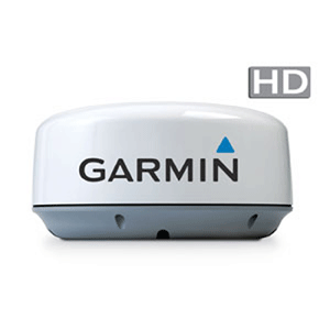
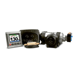
The full suite of Garmin electronics selected by Chaparral also includes the GMR18HD and GMR24HD high-definition radomes, GMR404 open array radar , GSD22 digital sonar, VHF200 marine radio, and GXM51 XM satellite weather/audio antenna. For increased confidence at the helm, some models willalso offer the GHP10, Garmin's Marine Autopilot with its patented Shadow Drive technology that automatically disengages the autopilot if the helm is turned, allowing the helmsman to maneuver the boat.


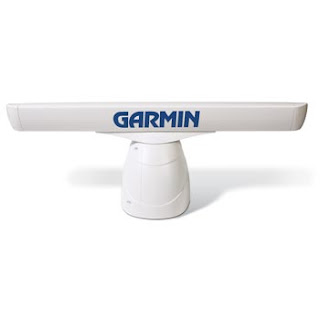
The GMR 404 is a 4 ft (1.22 m) open array scanner with 1.8 ° beamwidth and a range of 72 nautical miles. With this beamwidth and 4 kilowatts of power, the GMR404 offers outstanding clarity, precision and target definition. You also can use the Garmin GMR 404 to avoid traffic on the water with MARPA target tracking.The GMR 404 transmits data over the Garmin Marine Network, a 100 MB plug-and-play proprietary network that gives you the ability to expand your boat’s system as needed. Once connected to the network, any network-compatible Garmin chartplotter can double as your radar screen. And as an aid to locational awareness, you can overlay the GMR 404 radar image on the chartplotter's map page. You also can split the on-screen display so you can view the map and the standard radar page simultaneously.


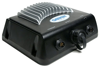
The Garmin GSD 22's digital design provides extraordinary target definition and deep water performance and allows it to transmit at up to 2 kW, depending on your transducer. The GSD22 also adjust gain and transmit power automatically to optimize the returns for shallow water. It can connect to a dual-frequency transducer and works with everything from a standard 500 watt transom-mount transducer to a heavy-duty 2 kW thru-hull or in-hull transducer and can reach a depth of up to 5,000 ft (1524 m).


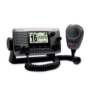
The Garmin VHF 200 provides full Class D Digital Selective Calling (DSC) capability via NMEA 0183 or NMEA 2000 connectivity. Should trouble arise, DSC provides distress calls with the push of a button. And if your boat already is interfaced with a compatible GPS chartplotter, you’ll get mayday signaling and a digital broadcast of your boat’s position. The VHF 200 also features NOAA weather alerts and Position Tracking, which allows a mariner to locate and keep tabs on up to three other boats in the area.


The Garmin GXM 51 Weather and Audio XM Satellite Receiver delivers XM satellite weather, including NEXRAD radar, and hundreds of XM radio stations right to your chartplotter. This water-tight, weather-resistent Marine antenna can be added to your Garmin GPSMAP 5x1, 5x6, 720, 720S, 740, 740S, 4208, 4210, 4212, 5208, 5212, 5215, 6208, 6212, 7212, and 7215. The GXM51 can display NEXRAD Radar, Lightning strikes, wave heights, wave direction, water temps, wind data and has a two-year warranty.


The GHP 10 marine autopilot adds a whole new level of versatility to the Garmin marine line. This breakthrough unit gives power boat users an easy to use autopilot system to rely upon for auto-guided navigation.The GHP 10’s patented Shadow Drive technology gives boaters the security of knowing they maintain control even when relying upon the autopilot. The Shadow Drive system automatically disengages the autopilot if the helm is turned, allowing the helmsman to maneuver the boat. The autopilot automatically re-engages when a steady course is held by the helmsman.


The GHP 10 is controlled using the GHC 10. This control unit communicates with the autopilot system via a NMEA 2000 bus, so autopilot heading data can be shared easily with other devices. The GHP 10's simple interface makes operation a cinch. And up to 3 GHC 10 controllers can be interfaced with a single GHP 10, allowing for autopilot capabilities in multiple stations on your boat.

Garmin's market breadth in the GPS industry is second to none, having developed innovative products and established a leadership position in each of the markets it serves, including automotive, aviation, marine, fitness, outdoor recreation, tracking, and wireless applications.

Labels: , , , , , , , , , , , , , , , ,

Thursday, March 03, 2011

The R&S SMBV100A Now Simulates GPS, Galileo And Digital Communications Standards In A Single Unit

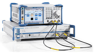
The field-proven R&S SMBV100A from Rohde & Schwarz sets new standards in satellite simulation. With the addition of a global navigation satellite system (GNSS) simulator to this flexible, multi-purpose vector signal generator, the R&S SMBV100A can now generate customized scenarios for GPS and Galileo from up to 12 satellites in realtime.

Users can quickly and easily define their own scenarios to test GNSS receivers under a variety of conditions. The R&S SMBV100A is the only simulator on the market that supports several satellite, mobile radio, wireless and radio standards simultaneously. Now, manufacturers of mobile phones or car radios with GNSS receivers need just one signal generator to check multiple functions at the same time.

GNSS receivers are typically characterized by running a number of tests that measure, for example, how quickly a receiver can fix its position after it is switched on, how much power it needs to do so, and how accurately the calculated position matches its actual position. In order to be able to make statistically sound statements about the characteristics of a receiver, users normally perform a complete series of tests under various scenarios. A satellite simulator that can simulate a wide variety of scenarios is ideal for this task. The GNSS solution for the R&S SMBV100A delivers the required flexibility.

Only a few keystrokes are needed to generate complex scenarios that are unlimited in time and utilize up to 12 satellites. The user can select the almanac file, the number of visible satellites and the receiver's geographical position. It is also possible to simulate stationary positions and scenarios that simulate the movement of a receiver along a chosen route.

The user can also simulate restricted reception conditions on the satellites, such as driving through a tunnel. Simulation of multipath propagation and atmospheric effects result in even more realistic transmission conditions. For full GNSS functionality, the R&S SMBV100A also provides hybrid GPS and Galileo scenarios for testing multistandard receivers.

The R&S SMBV100A GNSS solution offers customization options that allow users to change the configuration of the signal generator to keep pace with new test requirements. New features can be added on an as-needed basis. Additional functions, such as 12 instead of 6 satellites, can be activated with a license key. This eliminates the downtime associated with hardware installations.

Today, GNSS receivers are a standard feature in many mobile phones and car entertainment systems. Even chipsets in pure navigation devices are increasingly multistandard-capable and – at the very least – often support Wi-Fi and Bluetooth. In addition to generating GNSS signals, the R&S SMBV100A comes with options for generating standard-compliant signals for all major digital communications standards (LTE, HSPA+, WCDMA, WiMAXTM, GSM, WLAN) and radio standards (DAB, Sirius|XM radio, HD radio). Manufacturers of products with integrated GNSS receivers will find significant benefit in this versatility: They only need one R&S SMBV100A to test GNSS and other functions.

The new GNSS software options for the R&S SMBV100A vector signal generator are now available from Rohde & Schwarz. These include the R&S SMBV-K44 option (six satellites for GPS), R&S SMBV-K66 (six satellites for Galileo), R&S SMBV-K65 (A-GPS), R&S SMBV-K91 (extension to 12 satellites) and R&S SMBV-K92 (additional functions such as moving scenarios or multipath propagation).

Labels: , , , , , , ,