Galileo Europe GPS project will be started ....when?


Galileo is a multi-billion-euro venture which will complement - but also compete with - the US Global Positioning System (GPS), providing very accurate timing and location data that can be used in a host of applications from landing planes to co-ordinating financial transactions. The endeavour is controversial because its deployment is long overdue and significantly over-budget.
Satellite navigation users in Europe today have no alternative other than to take their positions from US GPS or Russian GLONASS satellites.As the use of satellite navigation spreads, the implications of a signal failure will be even greater, jeopardising not only the efficient running of transport systems, but also human safety.

OHB-System and UK-based company Surrey Satellite Technology Limited (SSTL) were awarded a contract valued at 566m euros (£465m) in January 2010 to start the production of the Galileo constellation.
Surrey will assemble the electronic payload for each satellite in Guildford before shipping it to Germany to be incorporated in the spacecraft bus, or chassis, prepared by OHB.
Surrey will assemble the electronic payload for each satellite in Guildford before shipping it to Germany to be incorporated in the spacecraft bus, or chassis, prepared by OHB.
Bremen-based OHB-System is part of the consortium that will build Galileo's first 14 operational spacecraft.The consortium's contract win was a spectacular achievement for the two firms which beat off the combined bid of Europe's two biggest satellite manufacturers, EADS Astrium and Thales Alenia Space (TAS).OHB-System then followed this triumph by winning the other high-profile European satellite-manufacturing deal of 2010 - the 1.3bn-euro contract to produce the next generation of weather satellites for the continent. In this case, the contract is shared with TAS.

When Galileo, Europe's own global satellite navigation system, is fully operational, there will be 30 satellites (27 operational + 3 active spares) in Medium Earth Orbit (MEO) at an altitude of 23 222 kilometres. Ten satellites will occupy each of three orbital planes inclined at an angle of 56° to the equator. The satellites will be spread evenly around each plane and will take about 14 hours to orbit the Earth. One satellite in each plane will be a spare; on stand-by should any operational satellite fail.

Planners and engineers at ESA had good reasons for choosing such a structure for the Galileo constellation. With 30 satellites at such an altitude, there is a very high probability (more than 90%) that anyone anywhere in the world will always be in sight of at least four satellites and hence will be able to determine their position from the ranging signals broadcast by the satellites. The inclination of the orbits was chosen to ensure good coverage of polar latitudes, which are poorly served by the US GPS system.
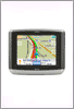
From most locations, six to eight satellites will always be visible, allowing positions to be determined very accurately – to within a few centimetres. Even in high rise cities, there will be a good chance that a road user will have sufficient satellites overhead for taking a position, especially as the Galileo system will be interoperable with the US system of 24 GPS satellites.
ESA will launch the first four operational satellites using two separate launchers. The first two satellites will be placed in the first orbital plane and the second in the second orbital plane. These four satellites, plus part of the ground segment, will then be used to validate the Galileo system as a whole, together with advanced system simulators.Then, the next two satellites will be launched into the third orbital plane. They will be followed by several launches with Ariane-5 or Soyuz from the Europe’s Space Port in French Guyana. The first services will be delivered when the constellation has reached its Initial Orbital Configuration.
When the 30 satellites are in space on all its three orbital planes, Galileo will be fully operational, providing its services to a wide variety of users throughout the world.
A user will be able to take a position with the same receiver from any of the satellites in any combination. By offering dual frequencies as standard, however, Galileo will deliver real-time positioning accuracy down to the metre range.It will guarantee availability of the service under all but the most extreme circumstances and will inform users within seconds of a failure of any satellite. This will make it suitable for applications where safety is crucial, such as running trains, guiding cars and landing aircraft.
Thereafter, four operational satellites - the basic minimum for satellite navigation in principle - will be launched in 2011 to validate the Galileo concept with both segments: space and related ground infrastructure. Once this In-Orbit Validation (IOV) phase has been completed, additional satellites will be launched to to reach the Initial Operational Capability. At this stage, The Open Service, Search and Rescue and Public Regulated Service will be available with initial performances. Then along the build-up of the constellation, new services will be tested and made available to reach the Full Operational Capability (FOC).
Once this is achieved, the Galileo navigation signals will provide good coverage even at latitudes up to 75 degrees north, which corresponds to the North Cape, and beyond. The large number of satellites together with the optimisation of the constellation, and the availability of the three active spare satellites, will ensure that the loss of one satellite has no discernible effect on the user.
Two Galileo Control Centres (GCCs) will be implemented on European ground to provide for the control of the satellites and to perform the navigation mission management. The data provided by a global network of twenty Galileo Sensor Stations (GSSs) will be sent to the Galileo Control Centres through a redundant communications network. The GCC’s will use the data from the Sensor Stations to compute the integrity information and to synchronise the time signal of all satellites with the ground station clocks. The exchange of the data between the Control Centres and the satellites will be performed through up-link stations. Five S-band up-link stations and 10 C-band up-link stations will be installed around the globe for this purpose.
As a further feature, Galileo will provide a global Search and Rescue (SAR) function, based on the operational COSPAS-SARSAT system. To do so, each satellite will be equipped with a transponder, which is able to transfer the distress signals from the user transmitters to the Rescue Co-ordination Centre, which will then initiate the rescue operation. At the same time, the system will provide a signal to the user, informing him that his situation has been detected and that help is under way. This latter feature is new and is considered a major upgrade compared to the existing system, which does not provide feedback to the user.
Labels: Astrium, COSPAS, EADS, FOC, Galileo, Galileo Control Centres, Galileo Sensor Stations, GCC, GLONASS, GSS, IOV, MEO, OHB-System, SARSAT, SSTL, TAS, Thales Alenia Space, US Global Positioning
posted by Bob Top @ 8:57 AM
![]()
![]()


0 Comments:
Post a Comment
<< Home