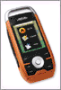
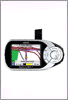
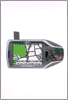
Google's new technology could enable location-finding services on cell phones that lack GPS.
them for location-centric services like getting directions and finding
nearby restaurants. While Global Positioning System (GPS) technology
provides excellent accuracy, only a fraction of phones have this
capability. What's more, GPS coverage is spotty in dense urban
environments, and in-phone receivers can be slow and drain a phone's
battery.
To sidestep this problem, last week Google added a new feature, called
My Location, to its Web-based mapping service. My Location collects
information from the nearest cell-phone tower to estimate a person's
location within a distance of about 1,000 meters. This resolution is
obviously not sufficient for driving directions, but it can be fine for
searching for a restaurant or a store. "A common use of Google Maps is
to search nearby," says Steve Lee, product manager for Google Maps, who
likened the approach to searching for something within an urban zip
code, but without knowing that code. "In a new city, you might not know
the zip code, or even if you know it, it takes time to enter it and then
to zoom in and pan around the map."
Many phones support software that is able to read the unique
identification of a cell-phone tower and the coverage area that
surrounds it is usually split into three regions. Lee explains that My
Location uses such software to learn which tower is serving the
phone--and which coverage area the cell phone is operating in. Google
also uses data from cell phones in the area that do have GPS to help
estimate the locations of the devices without it. In this way, Google
adds geographic information to the cell-phone tower's identifiers that
the company stores in a database.
Another approach is used by a startup called Plazes. This Swiss
location-tracking service has, over the past few years, established a
relatively small database of Wi-Fi hot spots around the world, manually
geotagged by Plazes users. Now, in a relatively large city, it's
possible to log on to Plazes using a Wi-Fi connection, and have the
software guess where you are because previous users have logged the
Wi-Fi hot spots' location, which can be an address or a business name.
In addition, researchers at Intel and the University of Washington
developed research software that uses a combination of Wi-Fi and
cell-phone tower radios to pinpoint a person's device. The now-complete
project, called Place Lab, takes advantage of any radio a person is
using, whether it's Wi-Fi on her handheld or laptop, or a cellular
signal from her phone, to triangulate location.
Google expects that over time, My Location's accuracy will improve. As
the database grows, says Lee, the service will become more accurate. It
will never be as accurate as GPS, but he expects that it could
eventually find a person within a couple hundred meters. And even at
that level of accuracy, there's still a lot of searching that Google can
do. "Search is really important," he says. "This product is searching
based on a map, but there are other types of local searching and
advertising and other products that can be made relevant" with the
technology, Lee says.
A few years ago, the Federal Communication Commission required
cell-phone companies to find a way to locate people making 911 calls so
that rescue workers could find them. The approach that most cellular
providers take is to use triangulation, which works if a person's phone
is visible to two or more cell-phone towers. But while a cellular
carrier can use information from any of its towers, Google and other
companies can't. The software available to them on a cell phone only has
access to the tower that the phone is using at any given time, not to
any neighboring towers.
posted by HighSpeedSat @ 11:08 PM
0 comments
![]()
![]()